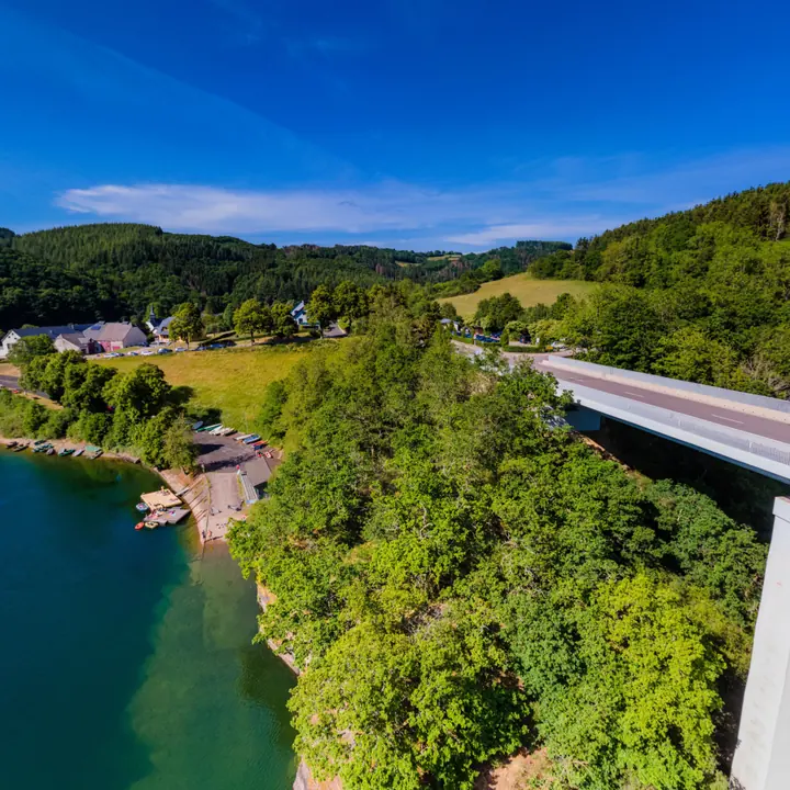
Drone photography and video in Luxembourg
Rise from the courtyard to above the roofs.
Aerial photos, aerial 360° panoramas linked into your ground tour, aerial video, aerial 360° video and 3D models: your place in its setting, from the same supplier as the tour.
Five ways to show it from above
Aerial photos
Your building, site or town in its setting, for the website, print, press and signage.
Aerial 360° panoramas
Linked into the ground tour: visitors rise from the courtyard to above the roofs, look around, and come back down.
Aerial video
Fly-overs and approaches, edited for your website, social media and screens.
Aerial 360° video
The viewer looks in every direction while flying, on a phone or in a VR headset.
3D models and Gaussian splats
Photogrammetry of buildings, sites and monuments: a model you can turn in the browser, and the 3D files.
For each audience
Communes & institutions
The town from above, new neighbourhoods, building sites stage by stage. More → — Communes & institutions
Companies & industry
The site and its access, construction, large installations such as solar parks. More → — Companies & industry
Venues & hospitality
The estate, the gardens and the way in. More → — Venues & hospitality
Culture & tourism
Castles, trails, landscapes and events from above. More → — Culture & tourism
Questions about flying
Can you fly anywhere?
Certified, insured, and only where flying is allowed. Drone flights follow the EU rules (the open categories A1, A2 and A3, and the specific category) and, since the end of 2025, Luxembourg's own drone law, which completes them. For every site go360 checks the official zone map and asks the DAC for an authorisation where the category requires it. Some zones, such as the airport, the Grand Ducal Palace and several city areas, need a permit or are closed.
Do people in the shot need to give consent?
Anyone recognisable needs to agree before the images are published, for each place they are published; for children, their parents. Otherwise go360 films so that no one can be recognised, or blurs them.
Can the aerial views link into our ground tour?
Yes. An aerial 360° panorama becomes one more stop in the tour, with doors up and down.
Who owns the aerial images and films?
You do. Everything is yours on payment, like the rest of the tour. Your rights
How is it priced?
No price list: what moves a quote is the number of viewpoints worth showing, the retouching, the languages, video and VR, aerial permits, how many times go360 comes back to shoot, and how you want it delivered. Never the surface. How go360 quotes
What happens if the weather is bad?
Aerial shots need dry weather and little wind to fly safely, and the right light and sky for the images to look their best. go360 flies only when both are right, and moves the date if the forecast isn't.
Show it from above.
Tell us about the place and what people should see from the air.